Why register to use CO2 Stored
Why register to use CO2 Stored and how do I access it?
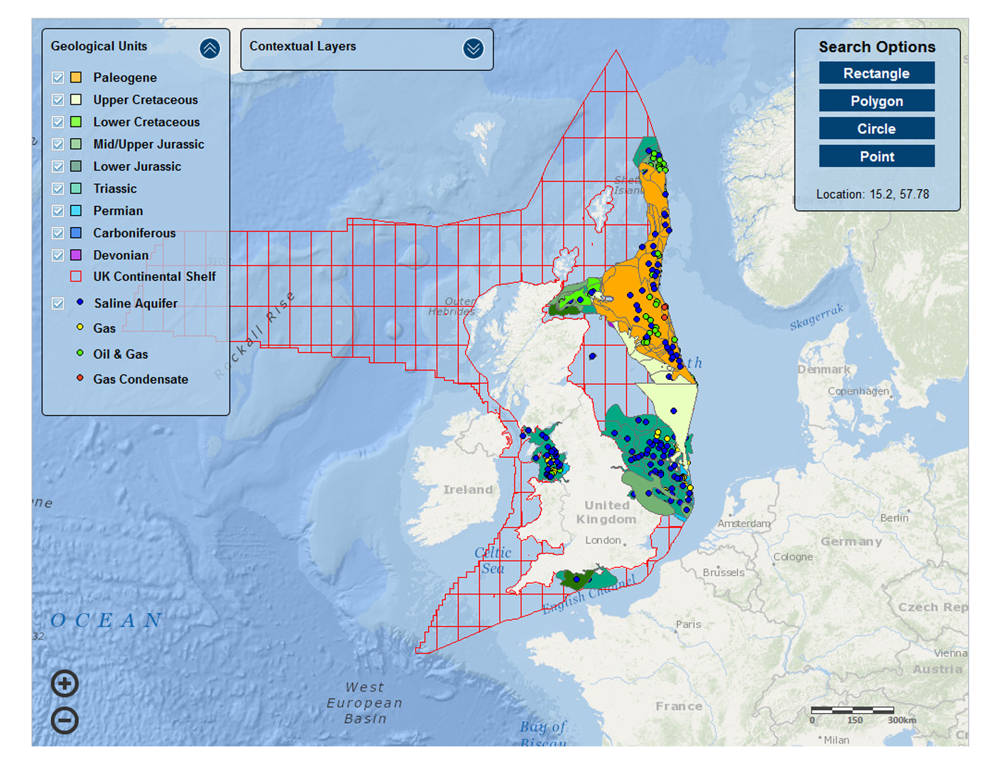
Access to CO2 Stored is through a secure online web enabled database and Geographical Information System (GIS).

Users of the database will have access to information for over 500 potential UK CO2 storage units collated as part of the UKSAP project and updated, validated and built on as part of The Crown Estate and BGS's ongoing development. The database includes derived data for each storage unit including: location, storage unit type, lithology, water depths, porosity, permeability, formation thickness, formation depth, pressures, and salinity.
Geological risk for each storage unit is provided to each User. This was assessed by a team of experts and contains geological faulting in the storage unit, caprock, compartmentalisation of the storage unit, likelihood of formation damage information. The risks are summarised in a range of risk profiles for each storage unit.
The user also has access to a range of calculated parameters, including storage capacity, injectivity, economic data and summaries of Monte Carlo simulations of parameters and results.
Data can browsed via a searchable map interface or through a search page.
For an example of the storage unit data contained within CO2 Stored click here.
Vision/development plans
In 2012 The Crown Estate and The British Geological Survey entered a partnership to host and develop the CO2 Stored database.
The partnership's vision was to provide a living, user friendly and stable research tool for enabling cost effective access to a unique combination of CCS-focused geological storage data and spatial infrastructure and activity data on the UK continental shelf, facilitating the development of a sophisticated planning capability in addition to the dissemination of UK subsurface storage data and knowledge.
In order to achieve this vision and working with stakeholders, over the following five years developments that improved and added to both functionality and the underlying data (see details in the CO2Stored database version log).
Implemented developments in the period 2013 to 2018 included:
- New website
- An improved searchable map interface
- Updated and improved geological data
- Facility for user-download of selected data
We are interested to hear your views. You can contact us using our Contact form.


